Monday 18 May 2015

Northwich Town

When we first visited Northwich we were a bit disappointed as lots of shops looked empty and closed up, especially in Weaver Square, however when we returned on Tuesday things looked much brighter. Lots of the empty shops had move to premises close by and there are effectively two indoor markets. What we didn’t find was anywhere we fancied for an evening meal and there seemed a lack of pubs. There is a Weatherspoons but that is well up in the town, there is very little down down near the river. What did strike us was the number of Estate Agents, probably more than charity shops.

The town does have some old buildings but most of these were lost due to bad subsidence when some of the old Salt mines collapsed mainly due to poor engineering and water erosion. In Victorian times they were building timber framed so that they could be jacked up as the ground subsided.DSCN0972
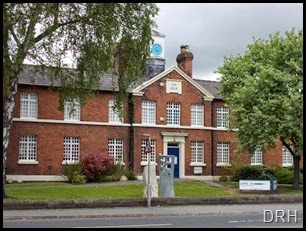
Northwich has a very good museum housed in the old workhouse and known as Weavers Hall. this houses information about the salt mining, the town in general including the subsidence and floods, there is also a section  on the river which includes it boat building passed with some interesting displays and videos.DSCN1194 DSCN1193

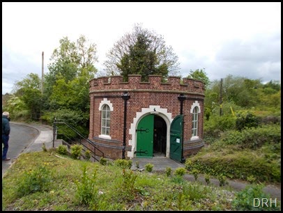
A short way from here is the old Edwardian Pumping Station. This is a Grade II listed building owned by United Utilities and run by volunteers.DSCN1195 It is open on a Sunday afternoon and houses two Haywood Tyler triplex lift and force pumps each driven by a single cylinder Crossley gas fired engine. The pumps were running while we were there.
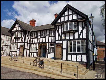
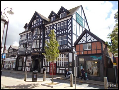
One of the other old buildings we visited while in town was the old Post Office sorting office which is now owned by Weatherspoons and is called The Penny Black.DSCN1221
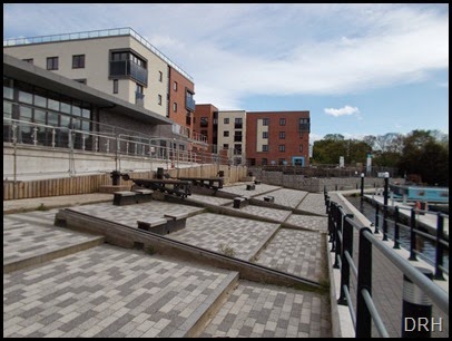
There is now a new marina in town and just behind it are the remains of the old side slip where boats would have been hauled out for repair . In its day  this was all under cover in a large shed.DSCN0970
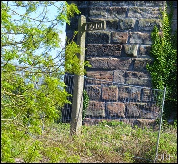
When the Weaver was still a commercial waterway  the company erected marker posts before each lock so the men working the boats knew where they were. The only remaining compete one we could find was in Northwich, there were several with just the posts standing but the fingers smashed off.DSCF8933
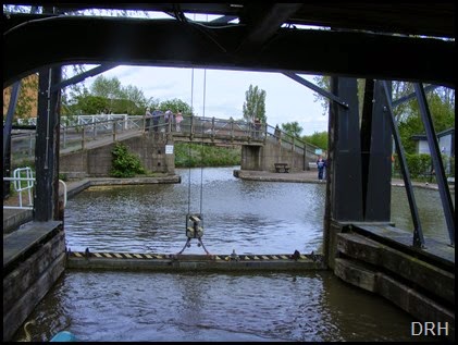
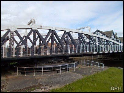
Northwich has several claims to fame, one of them is the Town Bridge. DSCN0965 This was not only the first floating  road swing bridge in the country, it actually floats in a tank of water, the rollers only guide it when it turns so reducing the friction, but it was also the countries first electrically operated swing bridge all back in 1899DSCN0968
Northwich was also the place that polythene was discovered by ICI in 1933 where would we be today without that. This lead to several explosions at the factory in the early years.

Northwich sits on old salt mines, some of these were not as well engineered as they may have been  and resulted in very bad subsidence in the town, not only that but there was also a great risk of more and even greater movement which meant that large parts of the town couldn’t be built on. To alleviate this in 2004 Northwich had the Worlds biggest programme for stabilising the mines by pumping them full of a mixture of Brine, cement and Pulverised fuel ash at a cost of £28 million. Over 780,500m3 of voids had to be filled. Of the materials pumped down the mines over 97% would have been disposed of as waste.

Technology

People often ask what technology we have onboard to produce my blog and remain in contact with the world.

The Hardware

When we were fitting out Harnser I fitted an aerial from the Boaters Phone Company and used a Nokia 6310i on Vodafone, with this combination I am able to get a phone signal on most places on the canal network. I use to connect this to the laptop with a cable and that way I could connect to the internet with a dialup modem using my contract minutes. How times have moved on. This was followed by an inferred link and then a Bluetooth dongle. I still use the same phone and aerial for my voice communication with Vodafone which is usable from inside the boat 99% of the time, even Braunston.

Today I have two ways of connecting to the internet, one is a WiFi connection to a MiFi unit running on Three on a 5 MB per month contract, this allows me to connect up to 5 devices to the internet, far more than I need as I only have a Laptop PC and an I Pad tablet.


My second method of connecting to the internet is using a Solwise Rocket WiFi antenna connected by cable to the laptop. This lets me pick up WiFi Hotspots that are transmitting in the vicinity, many pubs now offer free WiFi and if they are near a canals they can often be used, likewise a majority of houses now use WiFi modems and these can also be picked up. When we are at home our internet provider is BT and my contract with them gives me access to BT Hotspots free of charge whilst away from home.

The main disadvantage of this is that I can only connect the laptop and not the I Pad but as I really use the I Pad on the internet while a way from home it is not a major problem

The other hardware question I get asked is what camera I use and its nothing fancy, just a Fuji Finpix S5500 Bridge camera which I use in its fully automatic mode and just point and shoot, the only manual adjustment being the zoom. I don’t have time for anything else, I see something pick up the camera, switch on, point and shoot before I am passed it.

The Software

The blog is actually written on the Laptop PC using Microsoft Live Writer and then published via Blogger which is a free Blog hosting company owned by Google. The map to the right of the screen is a Google map where each night I manually mark our position. The map at the bottom of the text showing the days travel is also a Google map but the rout is produced by “Motion X” GPS tracker running on the I Pad.


How its Done

At the start of the day I put my I Pad on the rear slide, this is running two GPS programs. In the background it is running the GPS Tracker program “Motion X” and when we set off I start the tracker running, this is then left to do its own thing until we stop for the night, unless we are mooring up part way through to go shopping or something, when its paused. At the end of the day the program is again opened and the tracker stopped and saved. It is also shared by email to my own email address so that it can be read on my laptop. This is the only way I have found of transferring the information from the I Pad to the laptop to include in the blog.

While this is running in the background I have a second GPS program running called memory Maps, the great advantage of this program is that unlike a lot of online mapping programs, it will happily run using  installed maps so does not require a data connection to keep the map displayed and therefore doesn’t use any of my 5 MB data allowance.
The map I run on Memory Maps is produced by Paul Balmer and sold through his web site WWW.Waterwayroutes.co.uk . The maps are a detail guide to the canal showing bridges with name or number, locks, moorings and the duration you are allowed to stay, Water Points and all other services, Marinas,Hire Bases and Boat Yards. The map is marked off in half hour markers from junctions on each canal and include miles and kilometres. There are some free maps available on the web site so you can see the type of thing you are buying.

Putting the Blog together

Using Microsoft Live Writer I write the blog inserting the photographs I have taken during the day . At the bottom of the Blog text I put in a map of the days travels and the miles covered etc. This is the information from Motion X that I had previously emailed to my self, it arrives as a short text and a link to open the map recorded that day and looks like this :-

Hello,
Brian uses MotionX-GPS on the iPhone and is sharing with you the following track:
17 May 2015 10:25 am

Name:    Track 155   
Date:    17 May 2015 10:25 am   
Map:
(valid until Nov 13, 2015)    <http://gps.motionx.com/maps/c391bf070bdf2bac80e47e9d353a9197> View on Map    
Distance:    5.84 miles   
Elapsed Time:    2:12:11   
Avg Speed:    2.6 mph   
Max Speed:    4.6 mph   
Avg Pace:    22' 38" per mile   
Min Altitude:    27 ft   
Max Altitude:    93 ft   
Start Time:    2015-05-17T09:25:04Z   
Start Location:        
     Latitude:    53º 15' 48" N   
     Longitude:    2º 33' 22" W   
End Location:        
     Latitude:    53º 13' 22" N   
     Longitude:    2º 31' 56" W   

By clicking the link the map of the days travels opens on a Google Map base which can be zoomed and shown as map or satellite image. With this on the screen I use Windows “Snipping Tool” to save the map as a jpg with my photographs for the day. As you can see the distance and time data is available in the email.

To the right hand side of the blog is a map that shows our mooring location for the night. This is a Google Map that I produced “My Maps” and each evening when I am moored up I manually “Add a Marker” at our location. These stay on the map until we do our next trip when I delete them all and start again.

I hope this helps, if you have any questions I will do my best to help you, just drop me a line to email

Monday 11 May 2015

Anderton Lift


If you pre-book a passage on the lift you have to pay, if you just turn up and take your chance it is free, so we just turned up and as it happened exactly at the right time. There are reserved moorings outside the visitor centre for boats going down the lift which is where I moored, even though I wasn’t booked to go down.

I went into the visitors Centre and enquired at the desk about going down onto the river and got directed to a reception office with a service window down stairs. Here beside the window id a door bell for service which I pressed and waited. Eventually an employee who had been upstairs came down and went into the offices, not to the serving window and then came out again telling me the lady I needed to see knew I was waiting but would be about 5 minutes as she was busy. As her tea was on her desk I knew this must be the truth. The a man in CRT uniform came down and asked if it was my boat moored on the reserved mooring and if I was going down the Lift, I replied yes to both. At that point he called on his radio to open the top gate and said could I please hurry. The Lady eventually came to the window and asked the boat name and number. The chap wrote these down and was off. I had to give her my name, address, boat length, mobile phone number. I said I was surprised she didn’t know that from the registration number, but its a separate computer system. I even had to give my full address as it wasn’t tied into the post code system, they must have bought it cheep somewhere. Once that was sorted I went back up to the boat.

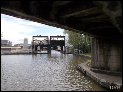
At the boat another chap was waiting, he would be loading me onto the lift so wanted to tell me the procedure then we were away. As soon as an oncoming boat had passed I turned in under the bridge and headed for the lift.DSCN0940 Through the bridge is a basin and this connects to the lift caisson by a trough 14+ft wide and 80+ft long. At each end of the through is a guillotine gate. at no time are both guillotine gates open. So the procedure is you enter the tough and stop a stop sign. The Chap loading the boats then closes the guillotine gate behind the boat.DSCF8863They now raise the guillotine gate at the the other end of the trough and the one on the inlet to the caisson simultaneously via an automatic linking arrangement that is operated by counter weights and gravity. The boat is now driven forward into the caisson and securely moored at the stern, I would imagine that a full length boat would require mooring at both ends or it would be to far forward.
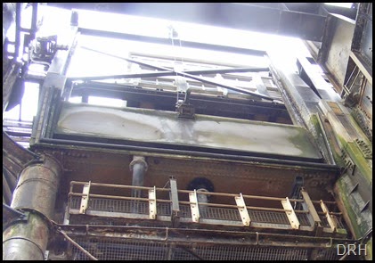
The pair of gates are then lowered behind it. When the weight is off the wire the catch disengages and allows the caisson to be lowered.Gate Latch

Once the caisson and trough gates are closed the water is drained from between them, this proves that both gates are sealed.

From our point of view we were now ready to be lowered, but they have to consider the other caisson which is at river level and being loaded with a trip boat to come up. Once both caissons are ready the journey begins, it is a little bit bounce as you start to move but after a foot or so is very smooth. As one caisson falls the other is rising.

To get a watertight seal between the caisson and the trough at the top the faces are angled with a rubber seal DSCF8879so as the caisson reaches the top of its travel it pulls tightly against the end of the trough. This seal is checked by filling the void between the gates with water before the guillotine gates are drawn.

Each caisson is mounted on top of a single hydraulic ram, the rams are interconnected hydraulically so the two caissons are balanced and only a small amount of pumped pressure is required to raise one caisson while the other falls. Originally this hydraulic fluid was the water from the river Weaver but over the years it caused server corrosion so now its on a closed oil system.DSCF8874

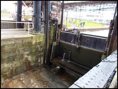
Once the caisson has reached the bottom where it sits in a dry pit a wedged joint is pulled up tight between the end or the caisson and the river gate frame to make a water tight seal, DSCN0954 the void between the caisson guillotine gate and the river guillotine gate is pumped full of water and checked for leaks then the gates are again simultaneously lifted with a similar latching mechanism as used on the top gates. Once the gates are lift its just a matter of starting the engine, untying and motoring out.DSCN0955 The journey time from entering the top trough to leaving the bottom gate was just 15 minutes.

  A video of our trip down on the lift, sorry about the sound track

Anderton Lift